 |
| Alaska DOT Photo |
So I emailed the Department of Transportation and got this quick reply:
"Hi Steve,
The bridge is still standing, but the approach to the bridge washed out with the shifting of the Copper River.
There is no plan at this time to rebuild the bridge, we just don't have the construction dollars available.
Please let me know if you have additional questions, or need more information.
Details on the bridge are available here: http://dot.alaska.gov/nreg/bridge339/
Best,
Meadow Bailey" (emphasis added)
The link takes you to this undated (Meadow emailed again and said it was 'this winter' so after the March 2014 link below) announcement:
Did you read carefully? The bridge was built in 1977 "based upon a predicted flood event of 21,300 cubic feet per second (159,300 gallons per second)." You can compare that to how many gallons per second go into your car at the gas station.Copper River Highway Copper Delta Bridge #339
There has been a recent decision to close the project due to the lack of funding for design or construction.
HistoryThe 56-mile Copper River Highway begins in Cordova and ends at the Million Dollar Bridge. The road provides access to vast areas of the Copper River Valley, is used frequently by hunters and recreationists, and potentially supports proposed resource development.
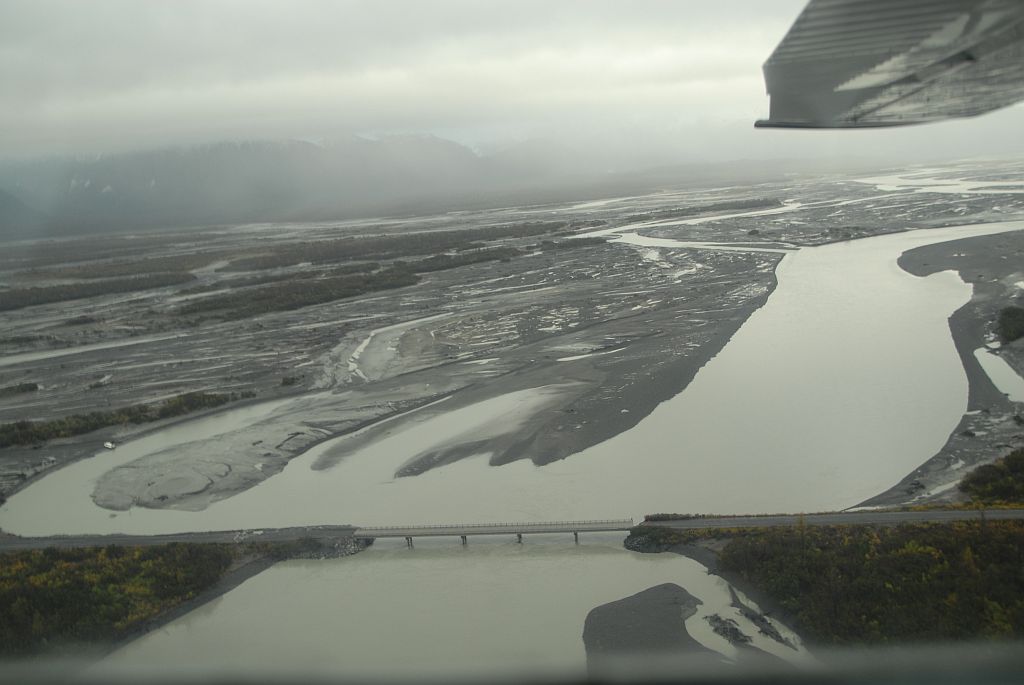
Bridge No. 339 is one of 11 bridges crossing the Copper River Delta. The bridge was constructed in 1977. The hydraulic design of the existing bridge was based upon a predicted flood event of 21,300 cubic feet per second (159,300 gallons per second).
Naturally occurring changes in flow between river channels across the delta led to a dramatic increase in the amount of water flowing under Bridge No. 339. This increase in flow was first noticed in 2009. In 2010 ADOT&PF along with the U.S. Geological Survey began a comprehensive monitoring program at the site. During the summer of 2011 the flow was measured at 89,000 cubic feet per second (665,800 gallons per second).
Early in 2011 a project was created to investigate ways to reduce flows and preserve the bridge. However, field measurements revealed that the increased flow has scoured away 50 feet of the river bed under the bridge. The scour has compromised the vertical and lateral structural capacity of the bridge piers and abutments. These conditions constitute structural failure of the bridge, requiring that it be closed.
However, in 2011, the water flow (presumably a regular event, not a flood event) was 89,000 cubic feet per second (665,800 gallons per second)." That's almost five times greater.
And this DOT page has links to other updates, including a three page pdf in March 2014 that says, among other things:
- "There are two different bridge options
- Option #1
Decked Bulb-Tee Girders on Drilled Shaft Piers.
Estimated construction cost: $66,250,000 - Option #2
Box Girders on Pipe Pile Extension Piers.
Estimated construction cost: $50,700,000" - "During the winter the road beyond milepost 16 is not maintained and is closed to vehicle traffic (typically November thru mid April). The 2010 summer Average Daily Traffic Volume (ADT) at Bridge 339 was 65." So, if we count summer as mid April to November 1
But there's more:
- "Since the bridge was closed in August of 2011, the river has continued to migrate east, washing out an additional 1,000 feet of the Copper River Highway. Erosion is now threatening Bridge No. 340 located 1,100 feet east of Bridge No. 339."
In any case, anyone who knows about the price of oil and the state of the Alaska budget knows neither of these options is going to happen any time soon.
If you want to get out to the Million Dollar bridge or to Child's Glacier, which in 2011 had a beautiful campground, you're going to have to go by boat or float plane.
No comments:
Post a Comment
Comments will be reviewed, not for content (except ads), but for style. Comments with personal insults, rambling tirades, and significant repetition will be deleted. Ads disguised as comments, unless closely related to the post and of value to readers (my call) will be deleted. Click here to learn to put links in your comment.